


Tropical Storm Arthur Forms & Heavy Rainfall Threatens Huntsville Area
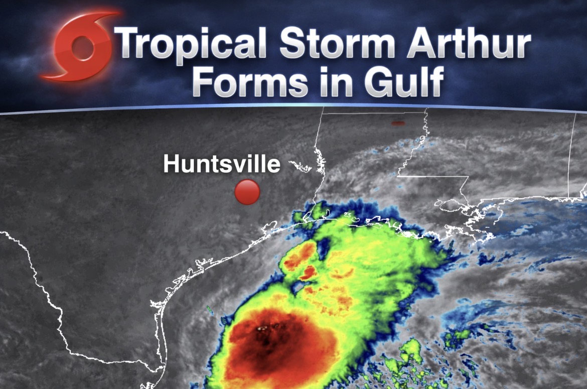
SOUTHEAST TEXAS — Tropical Storm Arthur has officially formed near the middle Texas coast, bringing a broad shield of heavy rain and strong winds that will impact much of East Texas — including the Huntsville area — through early Friday.
At the 10 AM update, Arthur was located about 40 miles east‑northeast of Port O’Connor with maximum sustained winds of 40 mph and a northeast movement of 9 mph. The storm is expected to track along the Texas coastline today before moving inland over southwestern Louisiana tonight.
While Huntsville is well inland and outside the tropical storm warning zone, the region is firmly within Arthur’s heavy rainfall corridor. Forecast totals of 5 to 10 inches, with isolated pockets approaching 20 inches, could lead to dangerous flash flooding, especially in low‑lying and flood‑prone areas.
Key concerns for the Huntsville area include:
- Flash flooding risk — Rapid rises in creeks, bayous, and urban drainage areas.
- Tornado potential — A couple of tornadoes are possible across the Upper Texas Coast region through Thursday.
- Travel hazards — Periods of heavy rain and gusty winds may make driving hazardous.
- Power disruptions — Saturated ground and sporadic wind gusts could lead to isolated outages.
Tropical‑storm‑force winds extend up to 175 miles from Arthur’s center, and coastal locations such as Galveston have already reported gusts near 48 mph. Storm surge of 2–4 feet is expected along the upper Texas and Louisiana coasts, though this will not directly affect inland counties like Walker.
Arthur is expected to weaken after landfall tonight and may dissipate by early Thursday, but its rainfall footprint will continue to pose a threat across East Texas and the Deep South.