Possible route maps for the newly planned East-West Interstate 14 through the Huntsville area released
By Staff Writer
07-10-2024

TXDOT (Highway Department) will hold a public meeting on the future Interstate 14 project through Walker County. The meeting that was to be held at the Walker County Fairgrounds July 11th was cancelled.
TXDOT released maps showing possible routes through the western part of the Huntsville / Walker County area. Included in these maps are the Huntsville Thoroughfare Planned Loop.
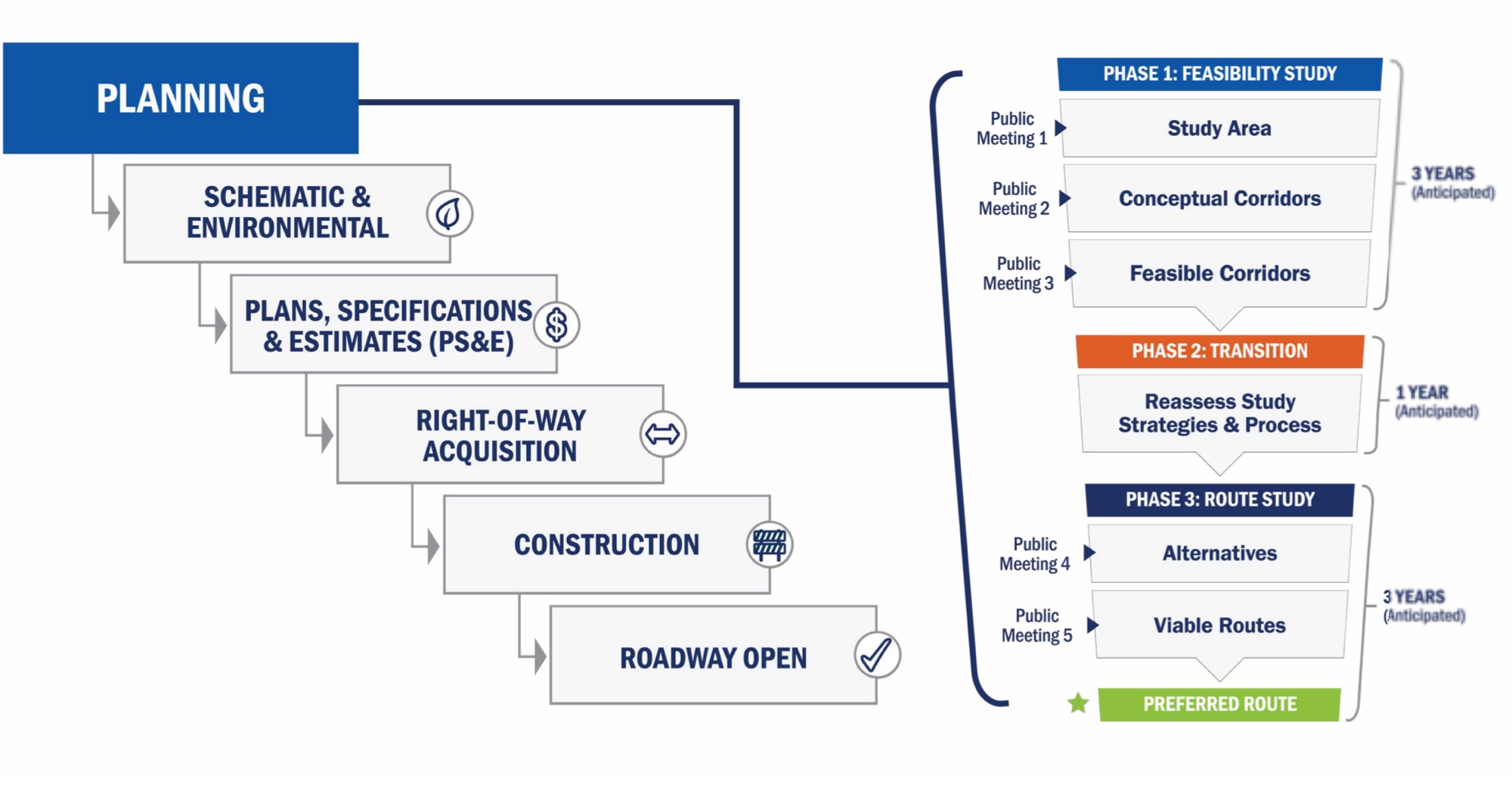
Currently TXDOT is in the planning phase for Interstate 14 through Huntsville. Approximately 25 miles of the system have been designated as an Interstate 14 in Texas from I-35 in Belton to US 190E in Copperas Cove.
The FAST Act created the Central Texas Corridor that would run near Highway 190 from Interstate 10 near Iraan to State Highway (SH) 63 in Jasper, connecting Louisiana to Texas at the Highway 63 Sabine River Bridge.

Federal legislation authorized a loop encircling the Bryan/College Station area as an interstate highway to be numbered I-214. A future loop (Huntsville Thoroughfare Planned Loop) is being planned around the Huntsville area.
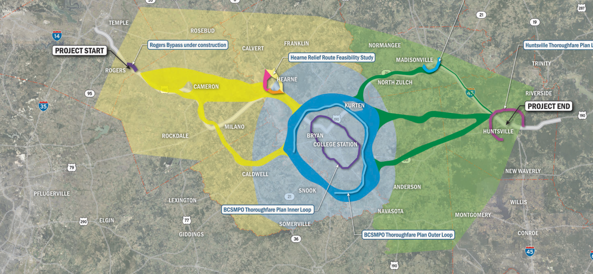
Possible routes through western Walker County may go through areas of Crabbs Prairie or use Highway 30. A longer route could go through Madisonville.


Property right of way acquisitions will require TXDOT to purchase property for the expansion. This may not be a bad thing for Walker County property owners who could reap millions of dollars with increased land value. Others may not be as lucky and may only be reimbursed the market value of their property through the eminent domain process.
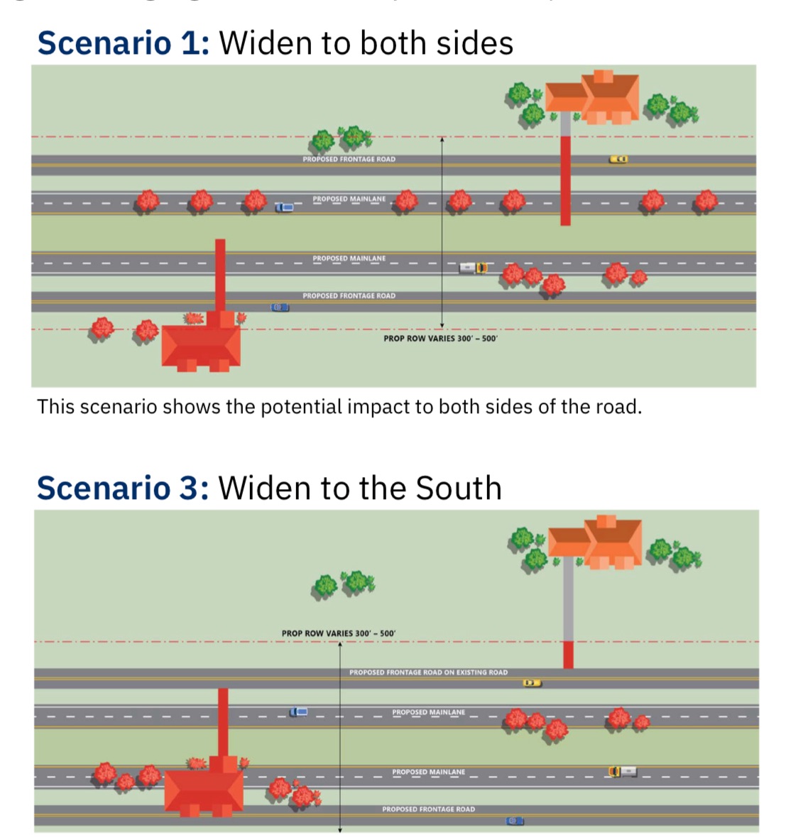
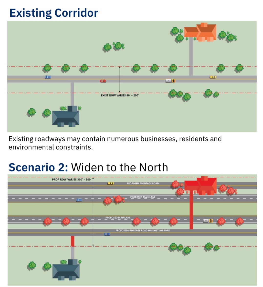
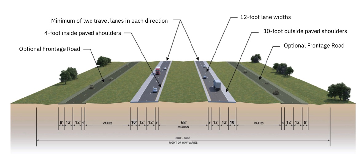
The planned Interstate will be between 300-500 feet wide.